
Thunder and lightning strikes recorded as storms arrive during UK heatwave

People across the South East woke to heavy rain and thunderstorms, after an overnight storm, ahead of what is forecast to be the hottest spell of the year
Lightning illuminated the skies during the early hours of Tuesday morning (June 23), as torrential downpours moved across the region.
Weather observer James Cosgrove described the spectacle on X, writing: "Wow, that was the largest lightning storm I've seen over London in some time. Almost 3,000 strikes recorded in the last two hours alone."
He added: "London has gone from complete darkness to thunderstorms to full daylight in the space of an hour."
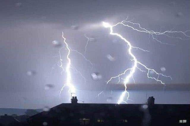

A Facebook page, called Sussex Weather UK and the South East, reported, at 6.30am, that thunderstorms were ‘still around’ this morning across East Sussex and Kent – ‘as they clear off South East in the next two hours’.
The post added: “They managed to dodge me at Bognor with just some distant lightning.”
The unsettled start comes just hours before temperatures are forecast to climb sharply across Sussex, with forecasters warning that the peak of the heatwave is still to come.
The Met Office said any remaining showers would quickly clear on Tuesday morning, leaving ‘plenty of sunshine’, and creating a ‘very hot and humid day’.
Forecasters expect conditions to become even hotter on Wednesday, with another sunny day forecast and temperatures rising further.
Red warning remains in place
The Met Office has issued a Red Extreme Heat Warning covering parts of Sussex on Wednesday and Thursday, warning that temperatures could reach between 38C and 40C.
The warning applies to parts of northern and eastern Sussex, including Crawle, Horsham, Billingshurst, Petworth, Haywards Heath, Uckfield and Crowborough.
The entirety of the South East is now covered by the rare UK Health Security Agency (UKHSA) warning for extreme heat. Health officials warn that the hot weather could pose a risk to ‘everyone’s health, not just vulnerable groups’.
In its latest update, the Met Office said the warning had been issued because an ‘exceptional spell of hot and humid weather is expected’, and warned of potential impacts ranging from health risks and travel disruption to pressure on power and water supplies.
Met Office deputy chief forecaster Mark Sidaway said: "Red warnings are reserved for the most severe events and we're expecting severe and significant impacts from this heatwave, with health impacts likely for many, even beyond those who are normally more vulnerable to the heat."
"The last time the UK recorded temperatures this high was in July 2022, but on this occasion the heat is expected to be accompanied by high humidity."
June record expected to fall
The Met Office says temperatures are expected to reach at least 39C in parts of southern England during the middle of the week, with a chance of exceeding that in some locations.
Forecasters now believe the UK's June temperature record of 35.6C, set in Southampton in 1976 and matched in London's Camden Square in 1957, is very likely to be broken.
Night-time temperatures are also expected to remain exceptionally high, with widespread tropical nights forecast. In some places temperatures may not fall below 20C overnight, offering little relief from the daytime heat.
Dr Agostinho Sousa, Head of Extreme Events and Health Protection at UKHSA, said: "A red heat health alert indicates a risk to life for even the healthy population.
"It is vitally important that people understand the risk posed by high temperatures like these, and take steps to keep themselves and their friends, families and neighbours safe."
Temperatures are expected to remain extremely high through Thursday, before gradually easing later in the week and into the weekend.